
Historical Gazetteer
- Ordnance Map
- 5216 Oberscheld
- Modern Maps
- Kartenangebot der Landesvermessung
- Topographical Maps
- KDR 100, TK25 1900 ff.
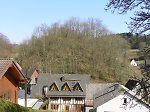


Burg Wallenfels
-
Burg · 481 m über NN
Gemarkung Wallenfels, Gemeinde Siegbach, Lahn-Dill-Kreis
- Settlement ↑
-
Settlement Type:
Burg
-
Localization:
9 km östlich von Dillenburg
-
Coordinates:
Gauß-Krüger: 3460893, 5627212
UTM: 32 U 460834 5625401
WGS84: 50.779044° N, 8.444474° O OpenLayers - Statistics ↑
-
Location Code:
53201905002
- Citation ↑
- „Burg Wallenfels, Lahn-Dill-Kreis“, in: Historisches Ortslexikon <https://www.lagis-hessen.de/en/subjects/idrec/sn/ol/id/14855> (Stand: 11.6.2014)