
Historical Gazetteer
- Ordnance Map
- 5324 Hünfeld
- Modern Maps
- Kartenangebot der Landesvermessung
- Topographical Maps
- KDR 100, TK25 1900 ff.
- Historical Maps
- Kurfürstentum Hessen 1840-1861 – 83. Hünfeld
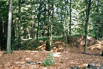


Burg Klinge
-
Burg · 319 m über NN
Gemarkung MackenzellBurg; Wüstung, Gemeinde Hünfeld, Landkreis Fulda
- Settlement ↑
-
Settlement Type:
Burg
-
Localization:
3 km südlich von Hünfeld
-
Earliest Reference:
1560
-
Historical Names:
- Siglindisburg
-
Coordinates:
Gauß-Krüger: 3556050, 5612400
UTM: 32 U 555953 5610594
WGS84: 50.644523° N, 9.791374° O OpenLayers - Statistics ↑
-
Location Code:
63101505001
- Constitution ↑
-
Former Administrative District:
Hünfeld
- References ↑
-
Bibliography:
- Knappe, Burgen in Hessen, S. 195.
- Historisches Ortslexikon Kurhessen, S. 282.
- Citation ↑
- „Burg Klinge, Landkreis Fulda“, in: Historisches Ortslexikon <https://www.lagis-hessen.de/en/subjects/idrec/sn/ol/id/6204> (Stand: 17.2.2014)