
Historical Gazetteer
- Ordnance Map
- 5123 Niederaula
- Modern Maps
- Kartenangebot der Landesvermessung
- Topographical Maps
- KDR 100, TK25 1900 ff.
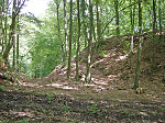


Burg Milnrode
-
Burg · 260 m über NN
Gemarkung Asbach, Gemeinde Bad Hersfeld, Landkreis Hersfeld-Rotenburg
- Settlement ↑
-
Settlement Type:
Burg
-
Localization:
6 km südwestlich von Bad Hersfeld
-
Coordinates:
Gauß-Krüger: 3544620, 5634310
UTM: 32 U 544528 5632496
WGS84: 50.842453° N, 9.63244° O OpenLayers - Statistics ↑
-
Location Code:
63200202002
- Constitution ↑
-
Former Administrative District:
Hersfeld
- Citation ↑
- „Burg Milnrode, Landkreis Hersfeld-Rotenburg“, in: Historisches Ortslexikon <https://www.lagis-hessen.de/en/subjects/idrec/sn/ol/id/3410> (Stand: 10.1.2014)