
Historical Gazetteer
- Ordnance Map
- 4620 Bad Arolsen
- Modern Maps
- Kartenangebot der Landesvermessung
- Topographical Maps
- KDR 100, TK25 1900 ff.
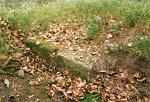

Nachtigallenburg
-
Burg · 250 m über NN
Gemarkung Viesebeck, Gemeinde Wolfhagen, Landkreis Kassel
- Settlement ↑
-
Settlement Type:
Burg
-
Localization:
4,7 km nordwestlich von Wolfhagen, unweit westlich von Viesebeck.
-
Coordinates:
Gauß-Krüger: 3508817, 5691448
UTM: 32 U 508740 5689611
WGS84: 51.357702° N, 9.125518° O OpenLayers - Statistics ↑
-
Location Code:
63302808003
- Constitution ↑
-
Former Administrative District:
Wolfhagen
- Citation ↑
- „Nachtigallenburg, Landkreis Kassel“, in: Historisches Ortslexikon <https://www.lagis-hessen.de/en/subjects/idrec/sn/ol/id/2526> (Stand: 24.6.2010)